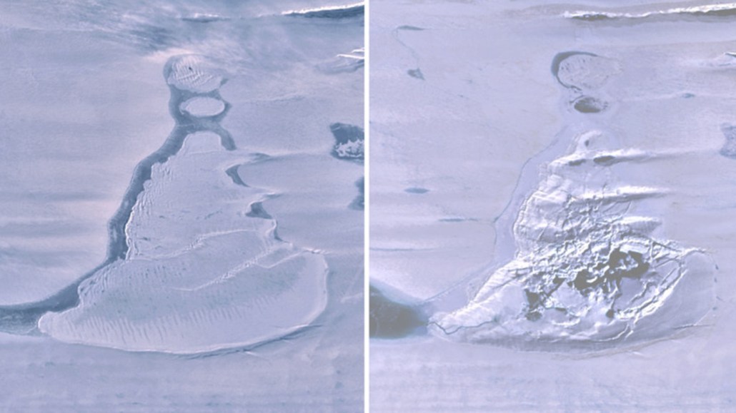
The Landsat 8 satellite snapped an image of an ice-covered lake on East Antarctica’s Amery Ice Shelf on March 31, 2019 (left). By September 14, 2019, the lake had drained away, leaving an ice-filled depression (right).
Landsat8/USGS and NASA
The Landsat 8 satellite snapped an image of an ice-covered lake on East Antarctica’s Amery Ice Shelf on March 31, 2019 (left). By September 14, 2019, the lake had drained away, leaving an ice-filled depression (right).
Landsat8/USGS and NASA