Bogland explores beautifully strange ecosystems
These water-logged spaces are filled with decay and teeming with life
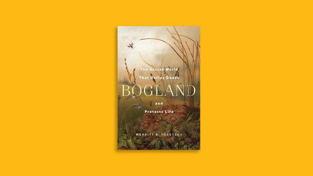
Ecologist Merritt Turetsky’s devotion to bogs, fens and other fascinating water-logged spaces saturates her new book.
Bogland
Merritt R. Turetsky
W.W. Norton & Company, $29.99
Thank goodness Merritt Turetsky became captivated by boglands. The ecosystem ecologist evocatively describes the beauty, danger and vitality of these ecosystems in her book, Bogland.
“Buffering the space between forest and river, boglands refuse to be defined as either land or water,” writes Turetsky, of the University of Colorado Boulder. Their soggy, oxygen-starved conditions make it difficult for microbes to break down organic matter, allowing carbon-rich peat to form. It’s that peat that sets boglands apart from all other ecosystems, she writes.
Boglands primarily consist of bogs and fens (and sometimes marshes and swamps). Bogs derive their water from precipitation, are lacking in nutrients and are known for sphagnum moss and carnivorous plants such as sundew and pitcher plants. Fens, in contrast, get their water from streams and groundwater as well as rain. Because fens have access to more nutrients, they support more diverse plant communities.
Anytime Turetsky dove into her own adventures in boglands, I was transfixed. It’s in these moments — trying to stay calm amid insect swarms, reaching her arms deep into the murk and wading through muck with other devoted scientists — that the book shines.
Turetsky’s bug baptism occurred on a college trip to a Nova Scotia bog as hundreds of mosquitoes, black flies and other insects quickly descended around her netted head. The sounds “are seared deep into my memory,” she writes. “After a half an hour I knew I needed to conquer the noise or be driven insane.”
In Brunei, Turetsky meets up with a peatland restoration research team. The group enters the waist-deep water, moves through a rehabilitated area, then reaches a healthy peat swamp. This secret garden, Turetsky writes, “is pure pitcher plant heaven — unlike anything in my northern bogs, with layers of pitcher plants not only growing on the ground but dangling from the trees.” The colors and shapes she describes reminded me of something Dr. Suess would dream up.
But along with their beauty and wonder, boglands harbor potential danger. Turetsky recalls getting lost when she ventured out alone to check something in a study plot. “Even in familiar terrain, boglands are deceiving,” she writes. “I was disoriented even as I felt surrounded by what seemed well-known.” Luckily, it wasn’t too long before she found her team — otherwise, they would have had to commence a search-and-rescue mission.
Turetsky’s devotion to boglands celebrates the contradictions in these ecosystems: Filled with decay but teeming with life; places of refuge and risk; an ally in a changing climate as well as a potential foe.
Peatlands occupy just 3 percent of the world’s land area but store around 30 percent of Earth’s soil carbon, Turetsky writes. “This far exceeds the carbon stored in the world’s forest biomass, despite forests covering a much larger area.”
However, boglands are being drained for agriculture and damaged by wildfires, drought and changing climate conditions. As more are destroyed, there is a serious threat that they could release their carbon stores, adding to greenhouse gas emissions, Turetsky notes.
I have a general understanding of climate science, but I wish Turetsky would have provided more basic information on that topic. Just as she lost her way in the bog, I got turned around by mentions of different warming periods and ice ages. But the bigger message of how boglands formed over geologic time and their contribution to Earth’s climate system still comes through.
Overall, my time spent in Bogland felt expertly navigated by Turetsky. I emerged firmly on team boglands. For me, the book’s ultimate gift was igniting a reverence for these incredible ecosystems. And to my great delight, Turetsky closes with a list of bogs, some with boardwalks, that people can visit. I’m grabbing my bug spray now.
Buy Bogland from Bookshop.org. Science News is a Bookshop.org affiliate and will earn a commission on purchases made from links in this article.