To detect CTE while alive, a test for another brain disease may help
An Alzheimer's biomarker might ID a condition associated with head trauma in contact sports

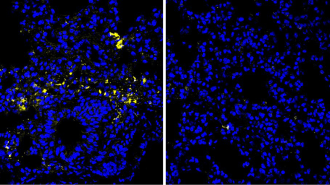
Repeated head impacts, like from heading a soccer ball, have been linked to increase risk of CTE, or chronic traumatic encephalopathy.
CHARLY TRIBALLEAU/Getty Images
LONDON — A protein marker of Alzheimer’s disease in the brain may also help diagnose cases of the brain condition chronic traumatic encephalopathy, or CTE, early data suggest.
The condition, which is linked to repeated head trauma, currently can be identified only in autopsies. But measurements of an Alzheimer’s-associated protein, eMTBR-tau243, might one day bring testing to the living: In confirmed CTE cases, levels of the protein increased the more advanced the disease had been at death, researchers reported July 15 at the Alzheimer’s Association International Conference.
The data, which have yet to be peer-reviewed, suggest a path toward a first way of diagnosing CTE in living people, says Chihiro Sato, a neuroscientist at Washington University in St. Louis. While the results would need to be confirmed in a larger dataset, “we think there’s potential.”
The ability to diagnose patients while they are still alive would provide clarity to patients about their well-being and be invaluable to getting them involved in future trials of any CTE treatments, says John Arena, a neurosurgeon at the University of Pennsylvania who was not involved in the research.
Diagnosing CTE currently requires a careful examination of the brain after death, which has complicated efforts to identify how many people are affected by the condition. A 2018 study found that CTE-like damage affected 1 of 164 donated brains. But CTE is far more common in people repeatedly exposed to head trauma, like athletes in contact sports. In 2023, the Boston University CTE Center reported that CTE pathology was present in more than 90 percent of brains in a sample of 376 former NFL players.
CTE is a type of brain disease called a tauopathy. This means, at a molecular level, the chief culprit is a protein called tau. In healthy brains, tau is an important structural protein — a kind of cellular logistics manager that moves nutrients around brain cells to keep them well.
But when coroners examine CTE-affected brains, they can see telltale tau tangles. These are messy, warped deposits of tau protein that damage brain cells, leading to memory problems, mood swings and suicidal thoughts.

Sato and her colleague, neuroscientist Kanta Horie, weren’t initially studying CTE at all. Instead, they were working on a new diagnostic for Alzheimer’s disease. Brains of people with Alzheimer’s disease also have visible tau dysfunction, although in different areas. (Horie is employed by Eisai Inc. — a U.S. subsidiary of a Tokyo-based pharmaceutical company that is developing treatments targeting eMTBR-tau243 — while working at Washington University.)
The team wanted to make sure that eMTBR-tau243, the first biomarker for tau in the brain in Alzheimer’s disease, was specific to that condition. The protein also goes out of control in other brain diseases, like progressive supranuclear palsy.
Horie presented data showing eMTBR-tau243 levels in cerebrospinal fluid taken from 112 patients with eight different brain diseases. Across all the diseases, only patients who had Alzheimer’s, or Alzheimer’s along with another brain condition, showed elevated levels of eMTBR-tau243. But there was one “very surprising” outlier, Horie said. This patient had advanced CTE.
The team realized that tau protein clumps in Alzheimer’s and CTE probably have similar enough structural characteristics to both be picked up by the test. So, working with researchers at the University of California, San Francisco, the team acquired samples of blood and cerebrospinal fluid from people who had also donated their brains. This included 11 blood samples from people whose brains had confirmed CTE pathology.
In these donors’ blood, the eMTBR-tau243 signal increased in a stage-specific manner — donors with mild, Stage I CTE had eMTBR-tau243 levels significantly lower than advanced, Stage IV disease. And all the levels were higher than in healthy brains, Horie says. The team was able to acquire only two brains with moderate Stage III disease, but Sato said the team saw a trend suggesting their levels would sit in between Stages I and IV.
The new findings are part of a wider effort by the CTE field to improve diagnosis, Sato says. Progress hasn’t been straightforward. In 2019, an expert panel developed a checklist for clinicians containing likely symptoms that might indicate that a patient had CTE damage in their brain. But Arena and colleagues showed in May that there was little correlation between patients who scored highly on the checklist and who later tested positive for CTE after death.
In other words, clinical checklists probably won’t be enough on their own to diagnose CTE in living people, Arena says. “We really need to develop validated biomarkers to supplement that clinical picture. That’s going to be critically important.”