Earth’s rivers cover 44 percent more land than we thought

Satellite maps suggest that these waterways traverse about 773,000 square kilometers

map of world’s rivers and streams

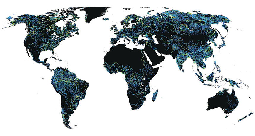
ROVING RIVERS  An updated map of the world’s rivers and streams reveals their global fingerprint. Colors denote a river’s width, from deep blue (30 meters) to yellow (thousands of meters).

G. Allen and T. Pavelsky/Science 2018

All of the world’s rivers and streams together cover more area than the U.S. state of Texas.

A new estimate based on global satellite images shows that these waterways squiggle their way across about 773,000 square kilometers of land — or just over half a percent of Earth’s nonglaciated land surface. That’s roughly 44 percent more than previously estimated, researchers report online June 28 in Science.

Such data are important for understanding Earth’s climate and the way it is changing. More river surface area means more contact between water and air, so rivers are probably exchanging more carbon dioxide with the atmosphere than currently assumed.

More Stories from Science News on Earth

From the Nature Index

Paid Content