First global maps of Pluto and Charon show the worlds’ highs and lows
Made with New Horizons’ data, the charts reveal never-before-seen details
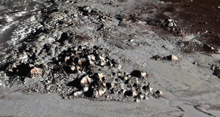
UPS AND DOWNS This view shows Pluto’s highest mountains, which rise 3 to 6 kilometers above the smooth nitrogen-ice plains of Sputnik Planitia. New maps of Pluto’s topography show more details of familiar landscapes like this one.
Paul Schenk/Lunar and Planetary Institute
The first global maps of Pluto and its moon Charon are now available, putting a bookend on NASA’s New Horizons mission.
“From a completionist’s point of view, they are all the good data we have, stitched together into a coherent, complete mosaic,” says planetary scientist Ross Beyer of NASA’s Ames Research Center in Moffett Field, Calif.
The charts focus on the 42 percent of Pluto and 45 percent of Charon where New Horizons snapped images from at least two angles during its 2015 flyby, revealing the landscapes’ height and depth (SN: 6/27/15, p. 16).
These measurements add topographic detail to already familiar features. For instance, the smooth plains of Pluto’s distinctive, heart-shaped ice sheet, known as Sputnik Planitia, lie two to three kilometers below the region’s rim.
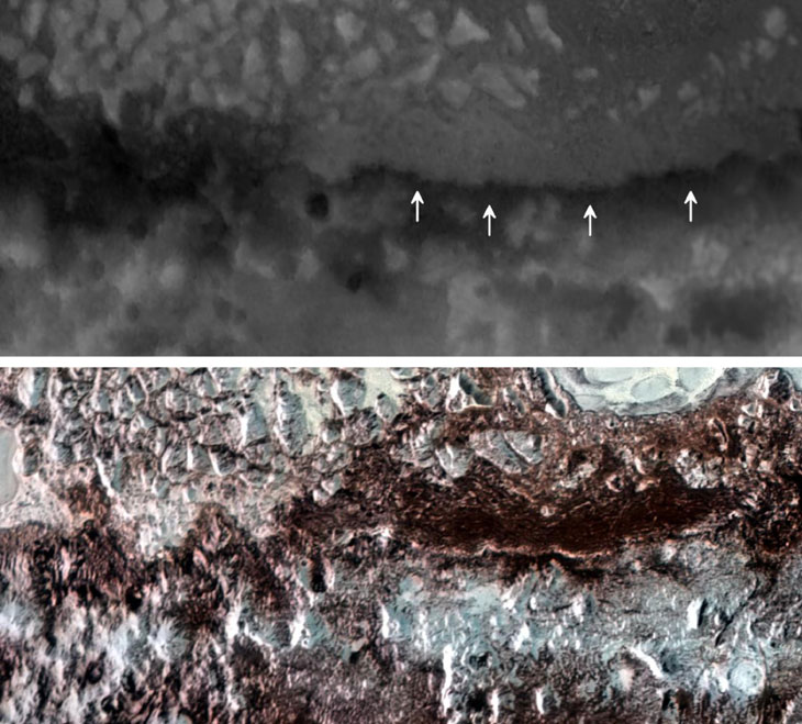
The biggest surprise on Pluto is a 3,200-kilometer-long system of ridges and troughs that traces a single, long line across the dwarf planet. That streak may stretch all the way around the globe, Beyer and colleagues report online June 11 in Icarus. This feature was only visible with all the data put together, Beyer says. The team doesn’t have a good explanation for its formation yet.
Charon’s map confirmed that the moon is made up of two large zones: smooth plains in the southern hemisphere and fractured blocks and canyons in the north, Beyer and colleagues report online July 3 in another paper in Icarus (SN: 4/2/16, p. 20). Initially, scientists thought both terrains were at the same elevation, but the new map shows that the plains are situated a kilometer or two lower than the northern terrain.
“We don’t know quite why that is yet, but it sure is interesting,” Beyer says.
Other planetary scientists will use these charts to continue unearthing Pluto and Charon’s secrets. “These maps really form the basis, the cartographic foundation, for anything any other scientist will do,” Beyer says.