The volcano watcher
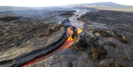
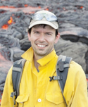
Matt Patrick’s office is perched not far from the summit of Hawaii’s busiest volcano: Kilauea. When it erupts, he has a good view. Of course, it’s his job to see every possible vista of the peak, whether it’s flying over in a helicopter, hiking to fissures and along lava fields or checking webcams, seismometers and satellites. Working at the U.S. Geological Survey’s Hawaiian Volcano Observatory, Patrick is part of a team that monitors the volcano’s every tremor, eruption, burp of gas and lava path. This diligence helps researchers track potential danger and understand the details of a volcano’s inner workings.


HVO/USGS
“Working on an active volcano is a pretty special opportunity,” Patrick says. And for the first time in at least 200 years, there’s major action at two different places on Kilauea. “We’ve had eruptions going on at the summit and East Rift Zone, going on for years,” he says. “And with the quality of data we’re collecting, it gets better every day.” One of Patrick’s specialties is the use of thermal cameras, which see through eruption fumes and can show clearly where a lava field is newest and thus most likely to continue flowing. Before joining the observatory in 2007, he used thermal images to spot signs of upcoming eruptions on Alaskan and Russian volcanoes and to track eruptions at Italy’s Stromboli. Now he spies on Halemaumau, the eruption crater resting at Kilauea’s summit. The work is revealing that the crater’s lava lake and the East Rift Zone may be physically connected.
He remembers one evening in 2011 when data pointed to an imminent eruption in the rift zone. A helicopter flight confirmed a fissure opening. Patrick and a colleague had hiked to the eruption site by midnight. Nothing happened, so they started hiking back. An hour passed. “Suddenly we saw the sky turn bright orange. We heard a jetting sound. We were able to see the spot we were just at had become a fountain.” —Kristina Bartlett Brody
One busy volcano
Credit: HVO/USGS
Matt Patrick of the Hawaiian Volcano Observatory used thermal cameras to capture the rapid draining of a lava lake (thermal image above) within the Halemaumau crater on Kilauea’s summit. His monitoring is revealing a hydraulic connection between the lava lake and the volcano’s active East Rift Zone and suggests that changes in the lake’s levels may be linked to eruptions.
Kilauea is one of the most active volcanoes on Earth today and can be active for decades at a time. Eruptions have been persistent along the volcano’s flank since 1983, and at the summit since 2008.
The observatory also monitors Mauna Loa and four other Hawaiian volcanoes that are quiet now but could erupt again. Mauna Loa eruptions can produce lava flows that move kilometers within hours — much faster than Kilauea’s lava streams. “You could even outcrawl the lava,” Patrick says of Kilauea.