Zoom in on amazing detail in NASA moon map
A new online map lets you explore the lunar north pole
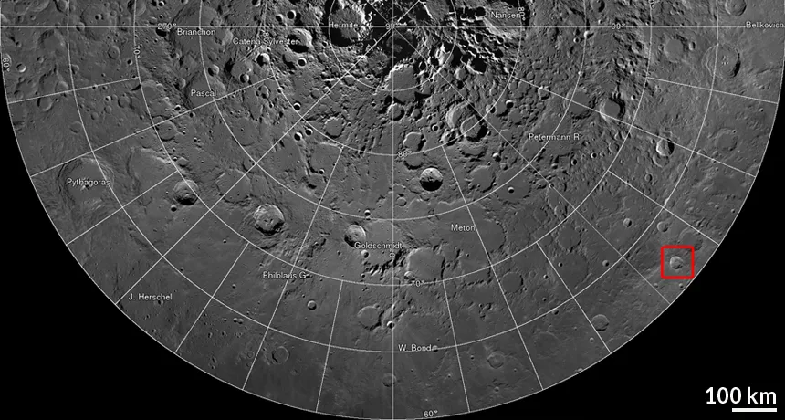
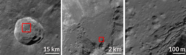
FLY ME TO THE MOON An interactive atlas of the lunar north pole allows users to explore the Moon’s terrain across a wide range of detail, even zooming in to see two meters of moon surface per pixel.
Goddard Space Flight Center/NASA, Arizona State Univ.
If a private spaceflight doesn’t fit your travel budget, NASA’s new interactive lunar atlas may be the next best thing. The Lunar Reconnaissance Orbiter team has stitched together 10,581 images into a gorgeous, detailed online map of the moon’s north pole.
The mosaic covers 2.54 million square kilometers — slightly larger than the combined areas of Alaska and Texas. The detail is stunning: At the highest zoom, each pixel shows a piece of the moon just 2 meters across.
Anyone who has used online maps will be familiar with the interface. Simple pan and zoom buttons allow users to soar and swoop over the lunar landscape. Dynamically updated labels mark interesting sites and keep you oriented.
The subtleties visible in the terrain are remarkable. You can see pock-marked impact melts, tracks from rolling boulders and fissures blanketing crater floors. Each vista highlights the cold beauty of our celestial neighbor and shows that the moon is an active, changing world.