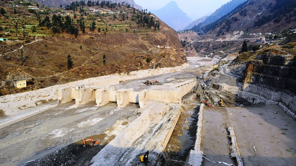
On February 7, a massive flood, set off by a massive avalanche of rock and ice, devastated the Tapovan Vishnugad hydroelectric power plant (shown) in India’s Himalayan Uttarakhand state.
Irfan Rashid/University of Kashmir
On February 7, a massive flood rushed through a valley in India’s Himalayan Uttarakhand state, washing out two hydroelectric power plants and leaving at least 200 people dead or missing. What triggered the deadly flood has been a mystery — but after amassing evidence from satellite images, seismic records and eyewitness accounts, a team of over 50 scientists now say they have solved the case.
The ultimate culprit was a massive avalanche of rock and glacier ice that tumbled 1,800 meters down a steep slope of Ronti Peak, setting off a cascade of events that led to the disaster, the researchers report online June 10 in Science.
This was no ordinary landslide, says Daniel Shugar, a geomorphologist at the University of Calgary in Canada. “This was a multi-hazard scenario where it was much more fluid and mobile than a landslide would be expected to be. It was a worst-case scenario of rock and ice and [the] height of the fall.”
Initially, the culprit was suspected to be a well-known high mountain hazard called a glacial lake outburst flood, in which dammed-up water suddenly spills over its bounds and rushes down the mountainside (SN: 2/9/21). But what little data were available in the immediate aftermath pointed to a possible landslide instead, Shugar says.
In the months that followed, he and his colleagues used numerous sources of data as well as computer simulations to painstakingly reconstruct what happened that day.
Here’s what the data show:
Starting around 10:21 a.m. local time on February 7, about 27 million cubic meters of rock and ice fell from the steep north face of Ronti Peak, which stands 6,063 meters above sea level. The landslide, consisting of about 80 percent rock and 20 percent ice, originated at a height of about 5,500 meters and tumbled downslope about 1,800 meters, traveling at a speed of up to 60 meters per second.
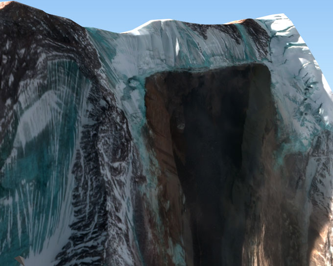
Digital elevation models now reveal a rock scar on the slope that wasn’t there previously. Earlier images of the site suggest that a very long and wide fracture in the overhanging glacier had opened up by 2018.
As the landslide then rushed down the Ronti Gad stream valley, wet material splashed up the valley’s sides, depositing sediment and large boulders on the valley walls. Satellite images also captured thick blankets of airborne dust — the first indicators that a landslide might be the culprit.
As the landslide continued downhill, the ice began to melt due to the friction, helping to speed it along. Then, the landslide encountered a sharp bend in the valley, and much of the solid material dropped out, shifting it from a thick, viscous flow to a faster-moving, more fluid flow. These rushing waters were now on their way to the two hydroelectric power plants in their path downstream. Eyewitness accounts saw only this part of the flood.
There are no easy answers for whether or how people can prepare for such a disaster — but the first step is a better understanding of possible causes, Shugar says. That’s where he hopes that this study can help. “We need to be doing a better job of hazard assessments, and not examining hazards in singularity.”
As for what role climate change may have played, it’s also difficult to say. There are no weather stations close to the site of the original slope failure that could provide temperature or precipitation measurements to assess changing climate in that region. But “we can say that climate change is increasing the severity and frequency of natural disasters,” by thinning glaciers and their underpinnings, Shugar says.
And it’s also clear that increasing development in the mountains compounds the likelihood of disaster, adding to the urgency of understanding the possible dangers, he notes. “If the mountains themselves are becoming more hazardous, and we’re also pushing farther into those mountains, that becomes a dangerous mix.”
We summarize the week's scientific breakthroughs every Thursday.