Mangroves move up Florida’s coast

Satellite images reveal tropical trees’ northward expansion

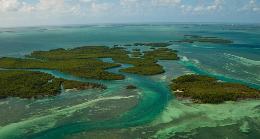
MOVING MANGROVES  Rising winter temperatures have allowed mangrove forests like these in Key West to expand north along Florida’s Atlantic coast.

Paul Nelson/U.S. Geological Survey

Florida’s mangrove forests are on the move. Satellite images from the past three decades reveal that these diverse coastal ecosystems have crept up the state’s Atlantic coast thanks to rising winter temperatures.

To chart the expansion of these tidal zone–loving tropical trees, Smithsonian Environmental Research Center ecologist Kyle Cavanaugh and colleagues compared images taken by NASA’s Landsat satellites from 1984 to 2011. During this period, the area occupied by mangrove forests south of about 30° N latitude, where Saint Augustine sits, grew by around 1,200 hectares, or 12 square kilometers. Most of the increase occurred north of 27.5° N latitude, around the city of Vero Beach.

The mangroves’ gains come mainly at the expense of salt marshes, coastal ecosystems that thrive in areas historically too cold for mangroves, the researchers report December 30 in the Proceedings of the National Academy of Sciences.

The researchers found through a statistical analysis that mangroves did not respond to higher average temperatures, but expanded in places where winter lows once fell below 4° Celsius but now rarely do.

More Stories from Science News on Climate