Portrait of a Martian crater
Swept by wind and apparently sculpted by water, this area within the Red Planet’s 140-kilometer-wide Gale crater was imaged by the Mars Reconnaissance Orbiter’s HiRISE camera.
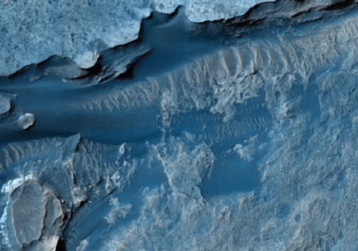
Revealing features only a half-meter wide, the image depicts part of the floor of the crater (top), which may once have held a lake, as well as an overlying mound of layered terrain (center and bottom) that probably includes volcanic ash as well as sediments deposited by water. Each of the layers “provides an important record of Martian geological history,” says Alfred McEwen of the University of Arizona in Tucson. A smoother section of the crater floor, adjacent to this area, includes a possible landing site for the Mars Science Laboratory, a sophisticated rover set to arrive in 2010. The HiRISE images of Gale and of some 30 other possible landing sites will help planetary scientists narrow the choices.