Stunning images reveal glacial landscapes under the oceans
New atlas offers a window into Earth’s glacial past
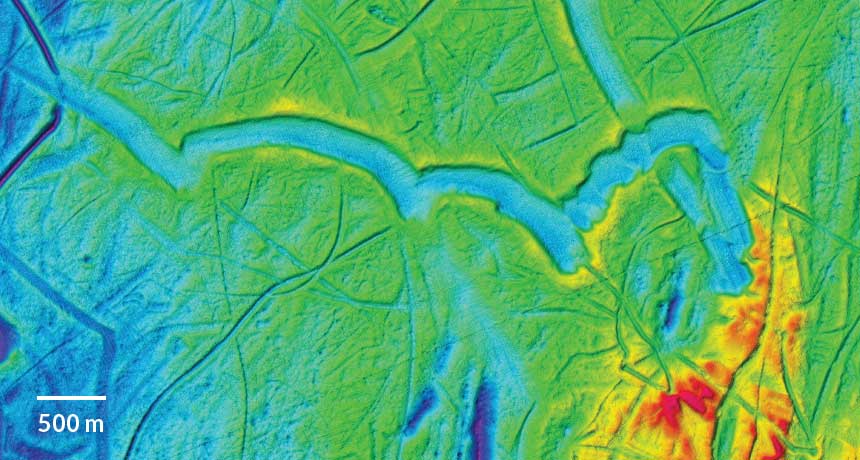
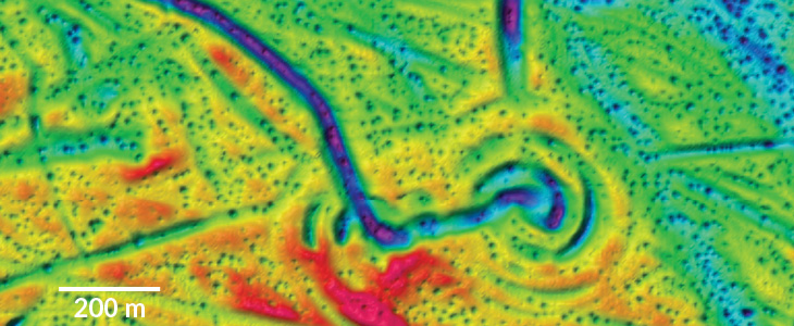
DIGGING IN Wide troughs found under 250 meters of water in the Barents Sea, north of Norway and Russia, were shoveled out by the broad bases of icebergs broken from ice shelves, confirming the existence of those shelves. Darker shades indicate greater depth.
Atlas of Submarine Glacial Landforms
The footprints of long-gone glaciers and icebergs are now frozen in time in a stunning new collection of images of Earth’s seafloor.
The Atlas of Submarine Glacial Landforms is a comprehensive, high-resolution atlas of underwater landscapes that have been shaped by glaciers, largely in polar and subpolar regions, and provides a comparative look at how glaciers, ice and related climate shifts transform Earth. Kelly Hogan, a marine geophysicist with the British Antarctic Survey and an editor of the atlas, presented it April 26 in Vienna at a meeting of the European Geosciences Union.
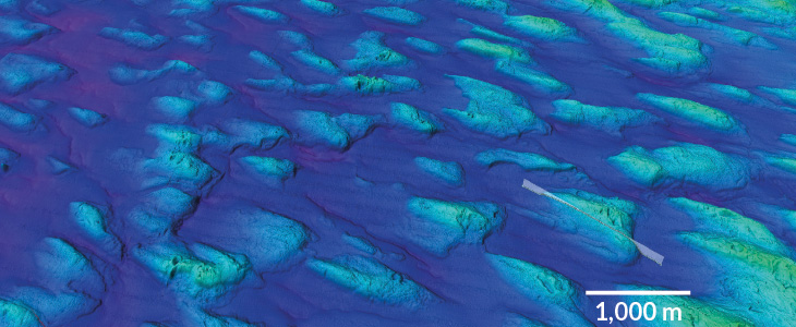
Most of the more than 200 images were generated from research vessels using multibeam bathymetry, which renders the seafloor surface in 3-D, exposing a region’s glacial history. For example, the distinctive asymmetry of 20,000-year-old glacial deposits called drumlins in the Gulf of Bothnia, between Finland and Sweden, suggests that ice flowed south, toward a larger glacier in the Baltic Sea.
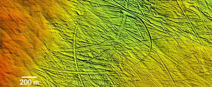
Other images reveal the tracks of icebergs that once plowed and scribbled the ocean floor, such as those seen in the Barents Sea in the Arctic Ocean. The tracks may look random, but they tell tales of past currents and water depth.
In all, the seafloor depicted in the atlas covers an area about the size of Great Britain. But the real impact of the project goes beyond individual images, Hogan says. She expects that scholars exploring glacial history, researchers predicting future ice behavior and climate scientists are among those who will keep a copy close at hand.