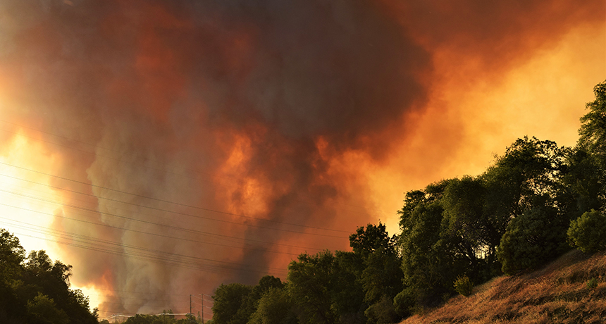
BIG BURN The Carr Fire, which has burned 930 square kilometers this summer, is one of the most destructive wildfires in California’s history.
Eric Coulter, Bureau of Land Management/Flickr
Wildfires are not known for their restraint. They’ll jump rivers, spew whirling dervishes of flames and double in size overnight.
Take the Carr Fire — one of California’s most destructive — sparked in mid-July when the rim of a flat tire met pavement. As the blaze grew, it jumped across the Sacramento River and sparked a flaming whirlwind that trapped and killed a firefighter near Redding. By the time it was fully contained on August 30, it had burned 930 square kilometers, destroyed more than 1,000 buildings, and killed seven people.
“Once these fires are spreading fast enough and intensely enough, you can’t stop them,” says Ruddy Mell, a combustion engineer with the U.S. Forest Service based in Seattle.
Federal and state agencies that manage wildfires use mathematical equations — fire models — to predict how blazes will spread and decide how to commit firefighting resources or whether an evacuation is needed. But the models can’t always predict when a fire will suddenly veer in a new direction or grow exponentially.
Now, scientists are developing more nuanced fire models with increasingly detailed satellite data and better understanding of how fires can create their own weather and fan their own flames. These finer-scale models take hours or days to run on a computer, so they aren’t likely to replace more quick-and-dirty field models for responding in the heat of the moment. But they can help scientists figure out what’s driving a wildfire’s behavior — and learn how to better protect communities from fires.
Record burns
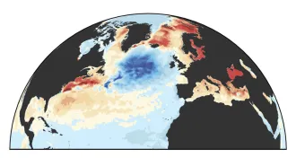
In 2018, wildfires are on track to cause at least as much damage in the United States as in 2017, when they burned a bigger area than in almost any year since consistent data collection began in 1983, according to the National Interagency Fire Center in Boise, Idaho. As of September 5, fires had torched almost 30,000 square kilometers nationwide, an area larger than Massachusetts. In the past few years, these wildfires have cast an especially thick veil of particulate pollution over the western United States (SN: 8/18/18, p. 9), where almost 100 large fires are currently burning.
While wildfires sparked naturally by lightning strikes are a healthy part of many ecosystems, humans have inadvertently made such fires worse. Years of forest management policies that suppress natural fires have made the ones that do bubble up even more ferocious, since there’s so much fuel on the ground. Plus, people start 84 percent of all wildfires, accidentally or on purpose, researchers reported in the Proceedings of the National Academy of Sciences in March 2017. Our influence has made fire season three times as long as it would be naturally, the study suggests.
Climate change is likely to intensify the problem. Much of the western United States will probably see an increase in the area of land burned over the next 30 years, according to a December 2017 study in PLOS One that analyzed temperature, snowpack and wildfire data. And in the future, cyclic climate fluctuations such as El Niño will exert a stronger influence on heat waves and wildfires, making such natural disasters more severe, researchers suggested in August in Geophysical Research Letters.
Capturing fire behavior through mathematical equations, though, is almost as hard as stopping the burn. Wildfires are influenced by a complex set of variables. What kind of plants cover the ground? Is the terrain flat or hilly? How fast is the wind blowing? What’s the temperature?
Fire managers take these variables into account, but their prediction models are designed for emergency scenarios where a fast response is key. The rough field equations don’t capture the finer details — the way fires interact with the atmosphere, for instance, creating their own winds that can blow flames and spit embers in unexpected directions.
Fire weather
Of course, gathering data about the way fires interact with the atmosphere poses some logistical challenges. “It’s pretty much impossible to set up instruments right next to a high intensity wildfire,” says Warren Heilman, a Forest Service meteorologist in Lansing, Mich. That would destroy the tools.
That’s where a new prediction tool developed by atmospheric scientist Janice Coen at the National Center for Atmospheric Research in Boulder, Colo., and her colleagues comes in. The way air moves when it’s heated by a fire, and the way that air movement feeds back to influence the fire’s behavior, “boils down to complex math and fluid dynamics,” Coen says. “If you get these things right, a lot of this horribly complex behavior unfolds.” These sorts of equations are already used in weather forecasting, but Coen’s team is applying them to wildfires through a model dubbed Coupled Atmosphere-Wildland Fire Environment model, or CAWFE.
Coen’s team recently applied CAWFE retrospectively to the 2014 King Fire, which burned almost 400 square kilometers in California’s Sierra Nevada. The fire had been traveling fairly slowly, but then raced 25 kilometers up a canyon in just 11 hours with puzzling ferocity — a nearby weather station had recorded calm winds at the time. News reports blamed drought for leaving the landscape parched and easily combustible, but Coen wasn’t convinced it was that simple.
Her analysis suggested that drought wasn’t the key driver of the fire’s sudden severity.
Instead, the King Fire’s fast spread up a canyon was fueled by atmospheric movement created by the fire itself, her team reported in May in Ecological Applications. Differences in atmospheric pressure create wind — air moving from higher pressure areas to lower pressure areas. When the fire warmed the air in the canyon, it lowered the air pressure and made the air expand and rise, creating winds far stronger than official measurements taken nearby.
Models like Coen’s can re-create other surprising fire events, such as the “firenado” whipped up by the Carr wildfire on July 26. That vortex generated winds exceeding 200 kilometers per hour and temperatures of up to 1500° Celsius, per CalFire estimates. Such flaming whirlwinds form when rising air heated by a wildfire collides with turbulent ambient air.
These detailed fire models offer clues on how to manage future fires: In analyzing the King Fire, for example, Coen’s team found that the amount of brush (and how dry it was) influenced the fire’s spread rate only on sloped ground. That suggests that, given limited resources, brush-clearing efforts might be most useful for slowing fire spread when focused more on hilly terrain than on flatlands.
Remember the embers
While Coen’s model looks at internal wildfire weather, other models being developed capture what happens when wildfires butt up against urban areas and threaten buildings.
How fires behave at this wildland–urban interface is poorly understood compared with fires within buildings or on open land, says Mell, the Forest Service combustion scientist. It’s more complicated to study, too, with more variety in the kinds of fuels available than one faces with a wildland fire in a remote forest. Plus, wildfires that strike communities usually ignite multiple buildings, creating a domino effect that isn’t an issue in, say, a standard house fire.
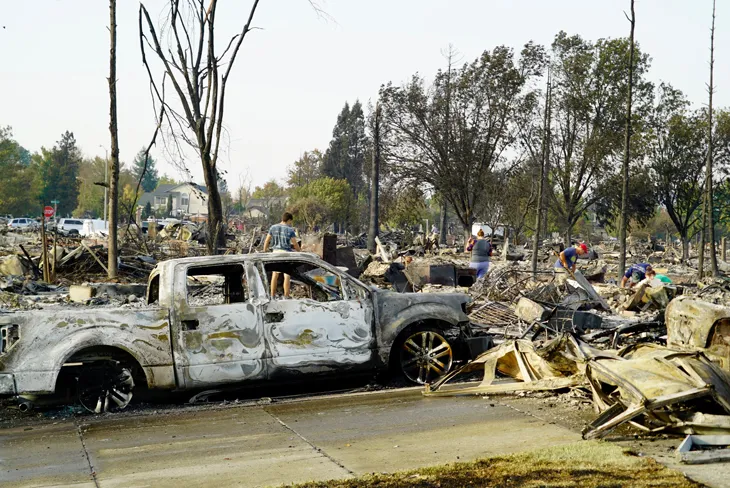
After the Tubbs Fire hit California’s wine country hard in October 2017, Mell visited a charred neighborhood outside of Santa Rosa, Calif. The suburb hadn’t been identified as a high fire risk, and indeed, flames never reached the community. The destruction came entirely from firebrands — chunks of burning vegetation or debris — that swept in on strong winds. Firebrands can pile up and ignite buildings, which can then generate their own firebrands. At that point, “it’s very difficult to stop,” Mell says.
The arrangement of buildings, the materials they’re made of and the types of surrounding vegetation all affect a community’s vulnerability to wildfire, but exactly how is still unclear. To tease out these interactions, Mell, like Coen, incorporates the physics of fire. But the focus is at finer resolution — on the way that fires burn on the scale of meters, rather than the way they influence air movement over kilometers.
He’s designing sets of equations that can estimate how a firebrand will transfer heat to a surface or how fuel sources will break down under certain temperature conditions.
The larger goal with such models: A more rigorous evaluation of ember hazards so that fire-prone communities can be designed and managed as safely as possible.
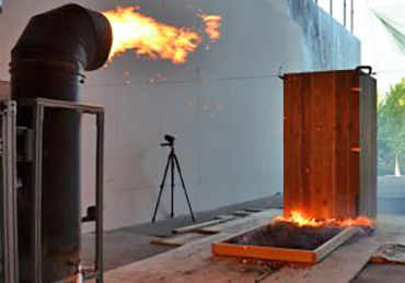
These wildland–urban interface models depend on data from lab experiments that test how embers fly and burn. Firebrands are unique from other projectiles because they’re burning up as they go, says Sam Manzello, an engineer at the National Institute of Standards and Technology in Gaithersburg, Md. Their density is constantly changing, which affects how they move through the air. Firebrands from torched vegetation behave differently than those from burning buildings.
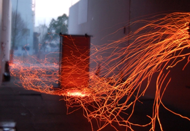
Some of Manzello’s work involves collecting embers after a fire and studying their properties — how big they are, what they’re made of and how much they weigh. His team has also built several “dragons” — contraptions that feed on woodchips then spit showers of embers. Scientists can control the size of the woodchips ignited in the dragon’s belly, as well as the speed at which they fly out of its mouth, to pinpoint vulnerabilities in the designs or materials of construction plans.
The tile roofs popular in California, for example, seem fireproof because the ceramic doesn’t burn. But “we’ve found out that, when we expose tile roofs to firebrand showers, [firebrands] penetrate under the tiles and light under the roof,” Manzello says. Embers land on the roofs and burn until small enough to fit through cracks between the tiles. Now, he says, wildland-urban interface safety standards have been updated: tile roofs should have combustion-proof materials underneath or materials that plug the gaps between them.