From the February 12, 1938, issue

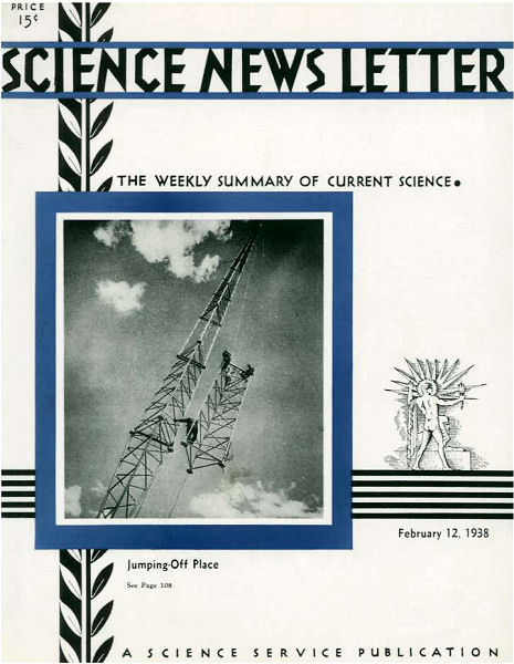
TOWERS REACH SKYWARD TO START RADIO WAVES

Babel’s Tower, we are told, was started by ambitious sons of men who wanted to reach the sky. It ended in frustration and a confusion of tongues, Modern towers of science reach higher than the builders of Babel probably ever dreamed of going, yet their modest ambition is only to give unconfused tongues a good jumping-off place for long journeys beneath the sky. KDKA’s new tower, shown on the front cover, was run up to 718 feet by its daring riggers before they called it a day; its voice goes round the world.

RIVER TOOK HARDEST WAY, FORMED YELLOWSTONE CANYON

Millions of years ago, a river in the Northwest took the “hard way.” As a result, today millions of tourists stand in awe, every summer, gazing unto the pastel-tinted Grand Canyon of the Yellowstone.

The tale is told by Prof. Arthur David Howard of New York University, in a newly published report to the Geological Society of America.

The Yellowstone River has its source in Lake Yellowstone, which lies right up against the Continental Divide, in the great national park of the same name. The river flows first north, then west, cutting deeply through a couple of mountain ranges, finally joining the Missouri at Ft. Union on the eastern boundary of Montana. Thence its waters continue their long journey toward the Gulf of Mexico.

At the southern end of Yellowstone lake, the Continental Divide is not at all the place of rocky steepness its name might suggest. There is a very wide pass—so wide and flat, indeed, that its floor is a wet meadow most of the spring and that eventually reach the Pacific, by a much easier route. Why did the river take the more difficult way?

The paradox is only apparent. Yellowstone waters also flow downhill; and downhill, in the early days of the river, was toward the north. The mountains were still a-making, and as they rose the river cut through and kept a way open.

During the Pleistocene Ice Age, glaciers apparently blocked the northern drainage one or more times, and the lake did then overflow the divide and drain toward the Pacific. But when the age-long ice jam went out, it resumed its northerly flow.

The river has not kept in the same channel all the time, Prof. Howard found. He confirmed the observations of other geologists who studied the terrain before him, that there is an old channel of pre-Ice Age date, high on the uplands above the present gorge bottom. He also describes a second channel, proved to be of Ice Age date by sediments of that age found in it. The river now occupies a third, comparatively new, channel.

YEARS OF DROUGHT COMING TO GREAT BASIN, IS WARNING

Years of drought, like the 7 lean years of Joseph’s Egypt, are due to grip the Great Basin area of the West, Dr. Ernst Antevs of the Carnegie Institution of Washington prophesies in a new publication of the American Geographical Society.

Dr. Antevs has made a special study of climatic cycles that swing over long periods of time. He finds that the down-curve in Far Western rainfall has already begun, and states that it is due to reach its climax in a terrific drought about 10 years hence.

The region for which Dr. Antevs makes his forecast lies between the Wasatch Mountains and the Sierras, comprising a total of abut 175,000 square miles in the states of California, Nevada, Utah, Idaho, and Oregon. He feels that farmers and stockmen in this region should make long-range plans to meet the situation.

More Stories from Science News on Humans