Climate simulations are underestimating how often intense rainstorms occur at warm temperatures, new analyses of weather data suggest. If true, the findings indicate that episodes of extremely strong precipitation, usually accompanied by flooding, will strike more often if the global average temperature continues to rise.
Scientists have long known that the warmer the air is, the more water vapor it can hold. That increased moisture-hoarding capacity also means that precipitation, once triggered, can be more intense, says Richard P. Allan, a climate scientist at the University of Reading in England. On average, the atmosphere holds 7 percent more water for each 1 degree Celsius rise in air temperature, he notes.
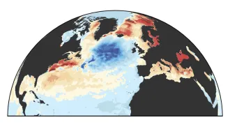
To assess the real-world relationship between temperature and intense rainfall, Allan and colleague Brian J. Soden of the University of Miami in Florida analyzed satellite measurements of precipitation over the oceans that were gathered from 1987 to 2004. Specifically, the researchers tallied how daily rates of rainfall for each 2.5°-by-2.5° patch of ocean — an area no larger than a 250-kilometer-by-250-kilometer square, about equal to the resolution of most climate simulations — varied with average temperature.
Statistical analyses of the satellite data, to be reported in an upcoming Science, indicate that “very heavy” precipitation episodes — those within the top 10 percent of rainfall totals for each patch of ocean — occurred between two and three times more often than an ensemble of climate simulations suggest.
That disparity isn’t the only difference between the satellite observations and the results of the simulations that the team used, says Allan. In the real world, the frequency of very heavy precipitation episodes rose at the expense of merely heavy precipitation episodes, those in the 60th to 90th percentile of daily rainfall totals. In climate simulations, however, episodes of very heavy precipitation became more frequent while those considered light precipitation fell dramatically, Allan says. Unlike the real-world observations, simulations didn’t detect a shift in the frequency of heavy precipitation episodes as average temperature increased.
The inconsistencies between observations and simulations could be related to poor resolution in the climate models or to how atmospheric processes are represented in them, Allan notes. Results of another recent study, published online July 20 in Nature Geoscience, bolster that explanation.
In that study, atmospheric scientist Geert Lenderink and colleague Erik van Meijgaard of the Royal Netherlands Meteorological Institute in De Bilt analyzed weather data taken every hour at their headquarters from 1906 to 2004. While this research focused on weather data at one site rather than a broad area, and also looked at data gathered hourly rather than daily, “the results tell the same story,” says Lenderink. On average, the strength of intense precipitation episodes rose about 14 percent for each degree Celsius rise in air temperature — about twice that expected based on climate simulations, he notes.
However, Lenderink and van Meijgaard found the unexpected rise in storm intensity occurred only during summer months, a time when most episodes of extreme precipitation are driven by atmospheric convection, a process that often takes place over a geographically limited area. In the wintertime, when most precipitation results from storm systems that cover broad areas, episodes of intense precipitation didn’t occur more often than climate models predicted.