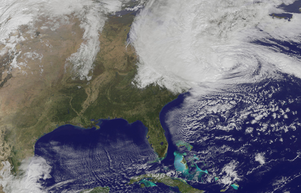
Hurricane Sandy barreled into the U.S. East Coast on October 29, bringing heavy rains, high winds and severe storm surges from the Carolinas to New England.
Sandy began its life inauspiciously the week before as “Tropical Depression 18” in the southwestern Caribbean Sea. Warm ocean waters, combined with little wind shear that could have torn the embryonic storm apart, allowed it to strengthen into a tropical storm and then a hurricane with winds of at least 74 miles per hour. At least 65 people died as Sandy ripped across Jamaica, Haiti, Cuba and the Bahamas.
As the massive storm skirted the southeastern states, first one trough of air pressure and then another guided it northeast and then toward the west and onshore. By this point it was transitioning from a hurricane (which gathers its strength from warm ocean waters) to an extratropical cyclone (which gathers strength from temperature gradients in the atmosphere).
No matter what you call it, Sandy is a record-breaking storm. It has already displayed the lowest central pressure ever recorded north of Cape Hatteras, N.C. As of 11 a.m. Eastern time on Monday, Sandy had a minimum central pressure of 943 millibars, breaking the record of 946 millibars from the 1938 “Long Island Express” hurricane.
This year’s Atlantic hurricane season has been busier than normal and even busier than predicted, with 19 named storms and 10 hurricanes. The season officially closes on November 30.


