Temperatures in Phoenix have reached above 43.3° Celsius (110° Fahrenheit) for 19 straight days, tying a record streak from 1974, with 9 straight days of temperatures not falling below 32.3° C (90°F).
Brandon Bell/Getty Images
The dog days of summer are upon us. Brutal heat waves are roasting regions around the globe, smashing records with unrelenting severity.
In the southwest United States and northern Mexico, devastating heat has been scorching the region for weeks. For 19 straight days and counting, temperatures in Phoenix have reached above 43.3° Celsius (110° Fahrenheit), surpassing a record streak from 1974. The Texas city of El Paso has endured an unprecedented 33 consecutive days of temperatures reaching over 37.8° C (100° F), and that streak is only expected to continue. And just after midnight on July 17, Death Valley, Calif., may have sweltered under the highest temperature ever recorded anywhere for that time: 48.9° C (120° F).
China has also been enduring extreme heat for weeks. On July 16, the township of Sanbao broke not only the national record with a temperature of 52.2° C (126° F), but also the record for highest temperature above 40˚ N latitude. Meanwhile, southern Europe is in its second heat wave in a week, with Rome recording a new all-time high of 42.9° C (109.2° F) on July 18 while a town in Catalonia, Spain set a new record for the region, 45.3° C (113.5° F).
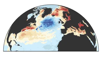
What’s concocting these bouts of extreme heat? It’s partly because the world has been exceptionally warm this year, thanks to the compounding of human-caused climate change with a natural climate phenomenon called El Niño, whose influence is known to temporarily warm our planet (SN: 7/13/23).
But it’s not just that Earth’s a hotter stovetop; the cooks have been busy. The jet streams, powerful ribbons of wind that control much of the planet’s weather, have been meandering and getting stuck, holding bulges of hot air over many parts of the Earth. While that’s not unusual, some scientists have suggested that climate change may be altering the dynamics of the consequential winds.
Here’s what we know about how climate change is impacting extreme heat and how these potentially dangerous events occur.
Extreme heat waves are becoming more likely
Let’s start with that hot stovetop. Humans have been warming the planet for decades by emitting climate-warming greenhouse gases into the atmosphere. That’s made extreme heat waves more common, many researchers say.
Since 2004, scientists have conducted attribution studies to estimate how much climate change may have influenced the probability and severity of a specific bout of extreme weather. These studies essentially simulate the world with and without climate change to compare how often certain types of extreme weather events occur.
The work of the World Weather Attribution initiative has repeatedly indicated that climate change has made extreme weather events like heat waves more likely and more severe (SN: 4/11/22; SN: 7/7/21).
A May report concluded that an April heat wave in South Asia — during which locations in Thailand and Laos set new national temperature records of 45.4° C and 42.9° C, respectively — was made at least 30 times more likely due to climate change.
Another study suggested that a different heat wave in northern Africa and southwestern Europe, which subjected some areas to temperatures 20 degrees C higher than is normal in April, was at least 100 times more likely due to climate change.
Climate change is pushing heat waves in general to have higher temperatures, but it’s having a particularly strong impact on the frequency of the most extreme events, says atmospheric scientist Noboru Nakamura of the University of Chicago.
“What used to be once every 1,000 years might now occur every 20 years,” he says. “It’s still a rare event, but … you can actually feel that in our daily lives.”
How heat waves form
What’s actually whipping up these summer scorchers, and why are only certain regions getting roasted?
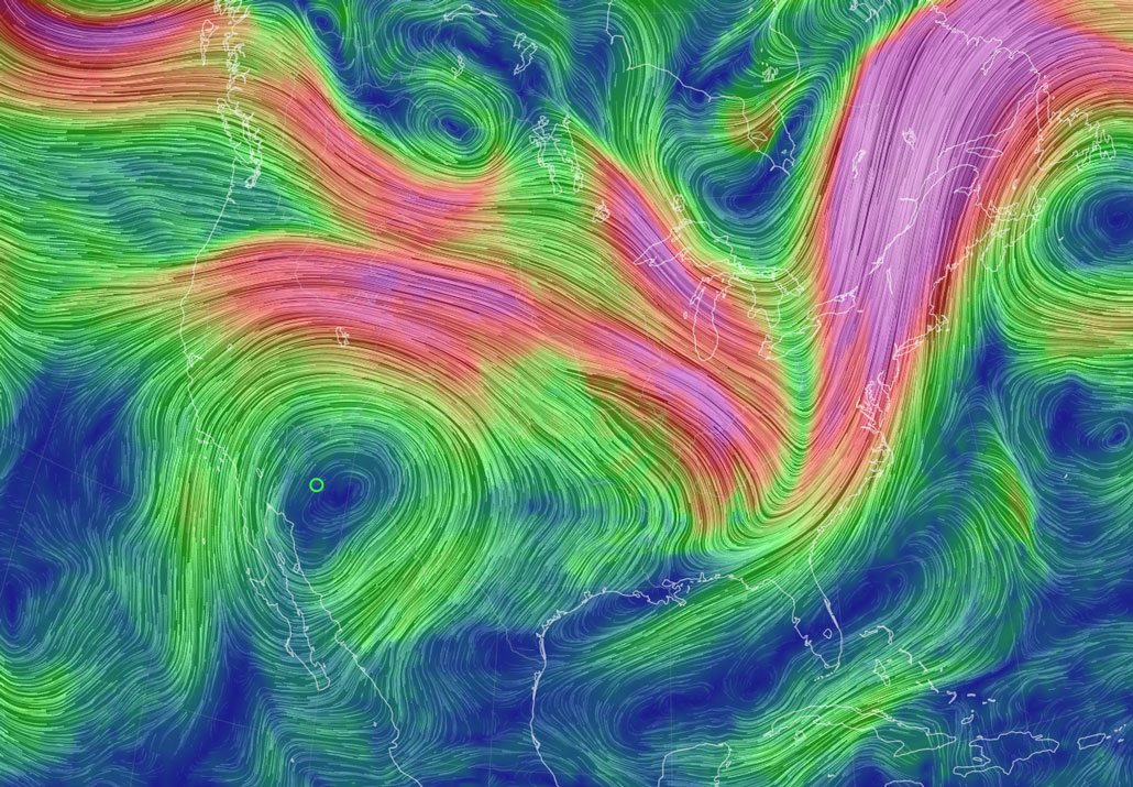
The answer lies roughly 8 to 14 kilometers high in the sky. There, the jet streams flow at about 177 kilometers per hour on average, though they can reach speeds of more than 400 kilometers per hour — faster than a Shinkansen bullet train.
These powerful winds control much of Earth’s weather by transporting high- and low-pressure systems around the world.
Jet streams develop where large masses of air with different temperatures meet, flowing faster where the temperature contrast is stronger. When jet streams are blowing strong, they tend to orient themselves more parallel to the equator, says atmospheric scientist Jennifer Francis of the Woodwell Climate Research Center in Falmouth, Mass. “But when those winds get weaker … then we tend to see the jet stream take these bigger meanders.”
When the jet stream meanders, it forms broad waves, with crests and troughs that reach north and south for hundreds of kilometers. Jet streams in the northern and southern hemispheres typically undulate more during their respective summers. Due to Earth’s axial tilt, polar regions receive more warming sunlight during their summers, weakening their temperature contrast with the tropics. As the waves become amplified, high- and low-pressure systems in the crests and troughs encroach farther north and south. Sometimes these pressure systems become stuck over one spot for days to weeks, causing weather to persist over a region.
When a high-pressure system gets stuck over an area, it pushes air down toward the surface, compressing and warming the air. The high pressure also pushes clouds away, clearing the sky for the hot sun to beat down unabated. These factors compound to produce a heat dome, a phenomenon that scorches and often dries landscapes.
An exception is when heat domes form by coastlines — such as the one that has formed by the U.S. Gulf Coast. Since warmer air can carry more moisture, heat domes near the ocean can make for weather that is both hot and humid, a potentially lethal combination for humans (SN: 7/27/22).
It’s a bit of a mystery why pressure systems become stuck, Nakamura says, making the phenomenon difficult to predict. It may occur when jet streams become especially wavy, he and a colleague reported in 2018 in Science. The waves may get stuck like cars in a traffic jam, causing weather to idle in place.
But this explanation is a theoretical one, and more evidence is needed to validate it, Nakamura says. Until then, he says, the underlying mechanics of those jams will remain elusive.
The jet streams’ uncertain future
A related, but similarly unresolved, problem is how climate change may affect the dance of the jet streams in the future. In 2012, Francis and a colleague proposed climate change could make the powerful winds more wobbly.
“The Arctic is warming about four times faster than the globe as a whole,” Francis says. “That means that the north-south temperature difference has been getting weaker and weaker.” As a result, jet streams may be becoming more unstable, she says, and more prone to meandering.
But that’s still “a very hotly contested hypothesis,” Nakamura says, pointing out that some climate simulations have suggested that in the Northern Hemisphere, the jet stream may actually become less wavy. “There is not a widely accepted consensus on this,” Nakamura says.
Even if the fate of the jet streams remains up in the air, one thing seems clear: Extreme heat waves aren’t going anywhere.