The magnitude 9.0 earthquake that struck the ocean bottom west of Indonesia on the morning of Dec. 26, 2004, triggered several tsunamis that killed an estimated 145,000 coastal residents and tourists, claiming lives on shores even thousands of kilometers away. Researchers are now analyzing the events that led up to the destruction and modeling their possible long-term effects.

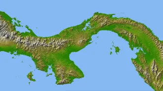
The largest temblor in 40 years occurred along a subduction zone where the immense fragment of Earth’s crust known as the India plate is forced beneath the Burma plate at an average rate of 6 centimeters per year. Analyses of seismic vibrations produced by the quake place its epicenter just north of the island of Simeulue, which lies about 150 kilometers off the western coast of Sumatra. From there, at a depth of 18 km, the rupture raced northwest at supersonic speeds for more than 200 seconds, says Chen Ji, a seismologist at the California Institute of Technology in Pasadena.
In all, slippage occurred along about 1,200 km of the interface between the tectonic plates—a distance that would span California from north to south with about 100 km to spare. At some spots along the interface, one plate may have slid as much as 20 meters past the other, says Ji.
In the most-affected region, a broad expanse of seafloor—and thus the sea above it—was abruptly thrust upward as much as 5 m. The waves spilling away from that sudden bump raced across the Indian Ocean at jetliner speeds, says Ji. The first tsunami may have been 15 m high when it slammed into Sumatran shores about 15 minutes after the quake.
Satellite photos taken after the disaster indicate that the tsunamis deposited beach sand and soil or stripped away vegetation as much as 3 km inland along much of Sumatra’s western coast. As of press time, the death toll in Sumatra was estimated to be in excess of 94,000. Sites farther from the quake zone experienced smaller but nevertheless deadly waves. Particularly affected were Thailand, which was struck by tsunamis about 75 minutes after the quake occurred, and Sri Lanka and India, which were pounded by devastating waves about 4 hours after the temblor. Death reached more than 5,000 km to African shores, claiming beachgoers and fishermen from Somalia to Kenya.
Notably, the Indian Ocean lacks a tsunami-warning system like the network of buoys and deep-sea instruments that monitors earthquake and wave activity in the Pacific Ocean (SN: 3/6/04, p. 152: Killer Waves).
Although portions of the ocean floor rose in many places as a result of the Dec. 26 quake, Ji’s geophysical models suggest that the seafloor sank as much as 2 m in other locales. Even some land was affected. Parts of western Sumatra may have permanently lost as much as 1 m in elevation.
Other effects of the temblor are subtle. The sudden surge of the India plate downward, toward the planet’s center, slightly altered the planet’s distribution of mass, says Richard S. Gross of NASA’s Jet Propulsion Laboratory in Pasadena. Just as spinning skaters rotate more quickly when they draw their arms inward toward their bodies, the Earth now completes its daily rotation in about 2.67 microseconds less time than it did before the quake, according to his calculations.
The region struck by the massive quake had previously been identified as one of about 80 areas likely to be stricken by a temblor of magnitude 7.0 or greater in the years between 2000 and 2010. Between 1990 and 2000, the region near the Dec. 26 temblor’s epicenter had experienced an above-average rate of earthquakes with magnitude 5.0 and above, says Donald L. Turcotte of the University of California, Davis.