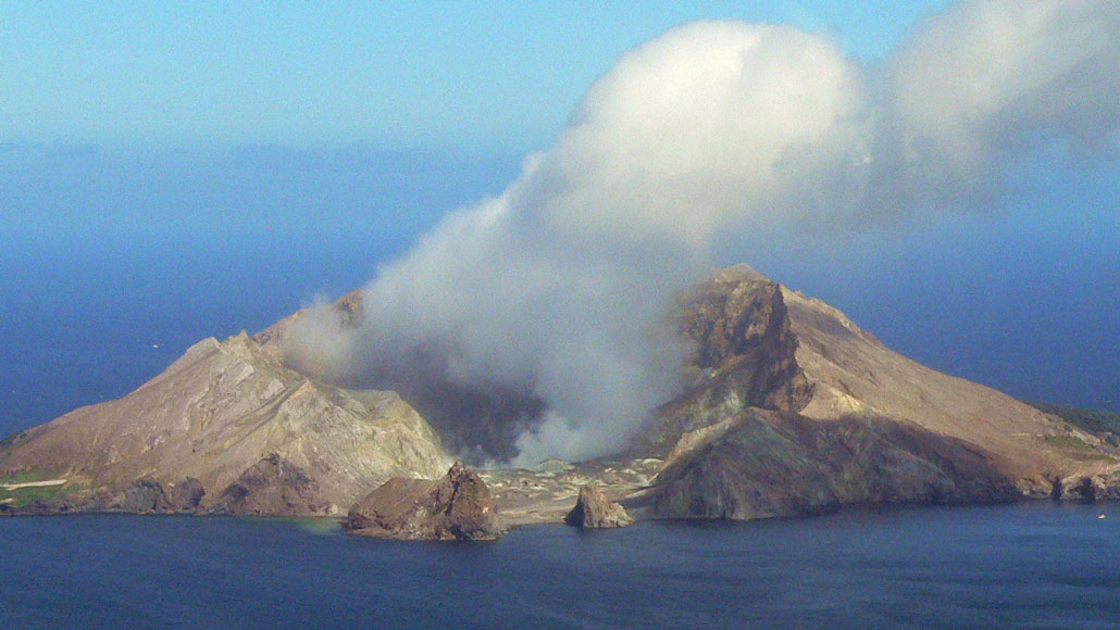
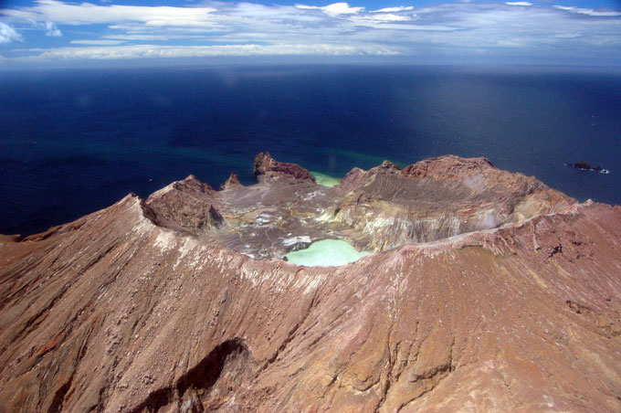
The Whakaari, or White Island, volcano, seen here in 2011, is New Zealand’s most active volcano. Satellite data are revealing new details about an eruption on December 9, 2019, that killed 22 people and injured 25.
Jens Bludau/Wikimedia Commons (CC BY-SA 4.0)
On December 9, 2019, a cloud of steam and volcanic gases blasted out of New Zealand’s Whakaari, or White Island, volcano. Relative to eruptions at other volcanoes, the explosion was small. But it claimed the lives of 22 people and injured another 25, many of whom suffered severe burns.
Now, using high-resolution satellite data and computer algorithms, scientists have revealed how gases released by the volcano subtly changed before, during and after the 2019 eruption. Observing such small changes using satellites could greatly improve volcano monitoring and help spot early warnings of eruptions, the researchers report June 18 in Science Advances.
Volcanologists typically use instruments on the ground to help warn of eruptions, monitoring changes in gases, such as carbon dioxide and sulfur dioxide, that quietly seep from volcanoes between blasts. But only around 50 of the world’s volcanoes are monitored in this way. Satellites have been used to study the plumes of large volcanoes, but the orbiting crafts haven’t been used to detect gases emitted by small eruptions.
Compared with large eruptions, like the blast that decapitated Washington’s Mount St. Helens in 1980, small-scale eruptions occur more often. So they pose a greater threat to people, says volcanologist Mike Burton of the University of Manchester in England.
By chance, the Sentinel-5 Precursor satellite flew over Whakaari about an hour after the 2019 eruption and collected data on light reflected from the volcano’s plume of ejected gases with its Tropospheric Monitoring Instrument, or TROPOMI. “What we realized was that we could use [satellites] to actually look at unprecedentedly small explosions,” Burton says.
From its seat in the sky, TROPOMI was better suited than ground instruments to gather information about the high-rising plume. And by the time TROPOMI passed overhead, much of the ash and other airborne particles that can blur ground observations of erupted gases had fallen out or evaporated from the plume.
Burton and his colleagues applied a computer algorithm to the TROPOMI data to calculate the backward trajectory of gases in the plume — essentially rewinding the volcanic eruption. This approach allowed the researchers to estimate how much sulfur dioxide that the volcano belched before, during and after the eruption.
Roughly 40 minutes before Whakaari erupted, the volcano’s sulfur dioxide emissions increased from 10 kilograms per second to 45 kilograms per second — signaling a potential eruption — and the plume of sulfur dioxide and other gases began to rise, the researchers found.
GeoNet, a New Zealand geological hazard monitoring service, had raised an alert several weeks before the eruption, after detecting an uptick of ground tremor, geysers bubbling up in the volcano’s crater lake and sulfur dioxide emissions using ground instruments, though tour companies continued to visit the island. But the new study is the first time that scientists have used a satellite to detect precursory changes in sulfur dioxide emissions before a small eruption.
We summarize the week's scientific breakthroughs every Thursday.
It was surprising that so much information about this small eruption could be gleaned using satellites, Burton says. “That’s a really exciting prospect because we can now expect to [measure] many more [eruptions] from space”
Changes in tremors caused by the eruption were recorded by a seismic station on the island and paralleled the researchers’ results. As sulfur dioxide emissions and plume height began to grow in the minutes before the blast, tremors increased, too.
This work shows that it’s now possible to measure gas emissions preceding small eruptions using satellites, which will complement ground-based systems and help provide warnings before eruptions, says, Jorge Andres Diaz a volcanologist at the University of Costa Rica in San Pedro, who was not involved in the study. “It [could] be your first line of monitoring, especially in places that are very remote.”
But predicting eruptions involves looking at multiple factors together, including those that TROPOMI can’t detect, he says. Tremors are one example (SN: 6/17/19). It’s also useful to monitor other emitted gases like carbon dioxide that, in conjunction with sulfur dioxide measurements, can reveal when new magma flushes into a volcano’s magma chamber, which can lead to an eruption. While TROPOMI can’t detect carbon dioxide, some other satellites can.
“I don’t want to say we can forecast explosions perfectly; we can’t do that,” Burton says. “But this is a key step. It opens up a whole new frontier.”


