A refined model can foresee the onset of the climate-altering phenomenon known as El Niño as much as 2 years ahead of time, scientists say. Because a strong El Niño can wreak damage costing billions of dollars, such advance notice could prove extremely valuable.
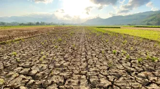
Under normal circumstances, winds carry warm surface waters westward across the tropical Pacific. During an El Niño, however, these winds diminish or reverse direction, and the warm waters of the western Pacific spill eastward. During a strong El Niño, sea-surface temperatures along the equator then remain abnormally warm for several months, and weather patterns shift. The southwestern United States and Peru, for example, get more precipitation than normal, but Australia and Indonesia receive lower-than-average rainfall.
Worldwide damage attributable to the 1997 El Niño, the strongest yet recorded, probably exceeded $20 billion, says David Anderson of the European Centre for Medium-Range Weather Forecasts in Reading, England. If El Niños can be reliably predicted, steps could be taken to minimize their economic impact, he says in the April 15 Nature.
El Niños occur at irregular intervals that tend to range between 2 and 7 years, but during some periods, the phenomenon is rarer. Only one El Niño occurred between 1936 and 1955, says Alexey Kaplan, a climatologist at Lamont-Doherty Earth Observatory in Palisades, N.Y. Since 1856, sea-surface temperatures across a large region of the equatorial Pacific have on 24 occasions shown the mark of an El Niño—a rise of more than 1°C above normal for an extended period.
Using wind and ocean-temperature measurements in climate models, scientists can predict El Niños 6 to 8 months before they arrive. Kaplan and his colleagues modified one of those models to better assimilate ocean-temperature data, and they calibrated it using temperature trends between 1980 and 2000. Then, they checked whether their model could foretell El Niños on the basis of Pacific sea-surface temperature measurements collected since 1856.
For six of the strongest El Niño events during that 148-year period, the model predicted as early as 2 years in advance when the warmer-than-average sea-surface temperatures would appear, says Kaplan. The model wasn’t as successful in foretelling mild El Niños. Kaplan and his colleagues describe their model in the April 15 Nature.
If the new simulation proves reliable for predicting El Niños years in advance, many regions could benefit. Consider Indonesia, a western Pacific archipelago that suffers droughts during El Niños. Those dry spells can significantly affect the nation’s rice production, says Walter P. Falcon, an economist at Stanford University. He and his colleagues estimate that when sea-surface temperatures in the equatorial Pacific are 1°C above normal in August, Indonesia’s rice harvest over the following year falls more than 1 million metric tons and world rice prices rise about 10 percent.
Accurate forecasts of an upcoming El Niño, Falcon says, could enable humanitarian-aid organizations to prepare, the Indonesian government to establish irrigation rules, farmers to choose suitable crops, and world commodity markets to predict food availability.


