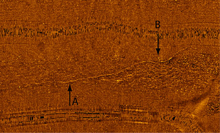
Sonar and video surveys of a long-flooded land bridge between Michigan and Ontario, Canada, reveal evidence of man-made structures that may have been used by hunters when water levels in the Great Lakes were much lower than they are today, researchers claim.


Between 8,300 and 11,300 years ago, when the North American climate was much drier, the water level in Lake Huron ranged between 55 and 100 meters lower than today’s level, says Guy A. Meadows, a physical oceanographer at the University of Michigan in Ann Arbor. During that interval, a now-submerged feature called the Alpena-Amberley Ridge — named for the cities in Michigan and Ontario that lie at each end of the lake-floor connection — would have stood high and dry, he notes. Meadows and John M. O’Shea, an anthropologist at the university, report online June 8 in the Proceedings of the National Academy of Sciences that their surveys of the 16-kilometer–wide, 160-kilometer–long submarine ridge have discerned intriguing signs of prehistoric human activity there.
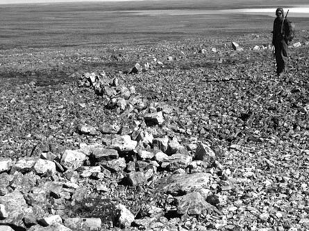
The researchers used side-scan sonar and video-equipped, remotely operated vehicles to survey two patches of lake bottom that together cover about 72 square kilometers of the submarine ridge, Meadows says. In one of those areas, sonar data reveal a sinuous, 350-meter–long string of small boulders that seem to have been arranged to visually accentuate a low ridge. Although generally unimpressive to humans — a person could easily step across the shin-high line of boulders, and even a small dog could leap it with a single bound — such structures are used today by arctic hunters to effectively guide caribou, Meadows notes. Groupings of large boulders at each end of the structure could have been used as decidedly low-tech hunting blinds.
Archaeologists are interested in such sites because not many of them have been discovered in this region from this era, the researchers report. The new findings raise the possibility that intact settlements are preserved beneath the lake. Many artifacts left by Native Americans of this period would have rotted if buried in soil, but might have been preserved in cold water-logged sediment.
Much of the Alpena-Amberley Ridge is covered with a thin layer of sediment, and the team’s video of the possible hunting blinds didn’t reveal any tools or other artifacts. A rather thick covering of zebra mussels — an invasive species that now plagues many of the Great Lakes — also blocked easy view of the lake bottom surrounding the purported manmade structures, Meadows says. So, he adds, scuba-equipped researchers will soon return to the area for detailed investigations.
“I can’t argue with anything that [Meadows and O’Shea] have found so far,” says John R. Halsey, Michigan’s state archaeologist, based in Lansing. The submarine site that the team describes “is like a stage set with no actors on it,” he notes. “It will take finding some artifacts such as flint chips or projectile points … to get archaeologists really excited.” Admittedly, he adds, “it’s rather difficult to find evidence of the area’s earliest residents 60 feet below Lake Huron.”


