PUT TO THE TEST For the last two years, U.S. agencies have been testing a new weather model, called GFS-FV3, against existing models. Now the new forecasting tool has officially been released.
TropicalTidBits.com
The National Weather Service has launched a powerful new weather forecasting model, just in time for the U.S. Atlantic hurricane season. But some meteorologists worry that, even after years of testing, the model is still not ready for prime time.
Over the last year, the weather service has been testing the upgraded tool, using it to do retrospective forecasts of three hurricane seasons and three seasons of winter storms. The researchers then compared those forecasts with those of the previous forecast model, known as the Global Forecast System, or GFS.
Scientists hope that the new model — called GFS-FV3, for Finite-Volume Cubed-Sphere Dynamical Core — is going to improve the accuracy of U.S. weather predictions, currently in third place behind those of two other European weather agencies (SN Online: 9/21/17). It’s the first significant upgrade to the GFS in about 40 years. And so far, the tests suggest that the FV3 model has more accurate five-day forecasts, as well as better predictions of hurricane tracks and intensification.
A dynamical core is the engine of a weather model, solving equations that describe the numerous, complex physical interactions between the atmosphere and ocean, so that they can be incorporated into the model. Launched June 12, the new model produces more detailed images faster than the previous one, which means that it can incorporate more weather processes that might otherwise be missed, the weather service says. Unlike the previous GFS model, GFS-FV3 is also able to simulate vertical movements such as updrafts, a key component of severe weather, at very high resolution.
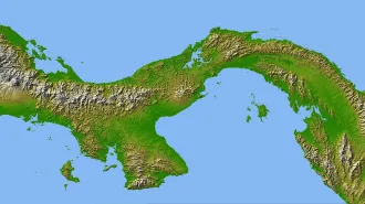
When it comes to forecasting hurricane tracks, the FV3 model showed some promise during the 2018 storm season. Its prediction of the track of Hurricane Lane, which struck Hawaii in August, had fewer errors than any other system, including the existing U.S. model as well as the top-performing tools, the United Kingdom’s Met Office model and the European Centre for Medium-Range Weather Forecasts model.
But some hitches appeared in the model’s predictions over the last winter. One problem was that a monthlong U.S. government shutdown in December and January delayed scheduled testing of the new model at the National Oceanic and Atmospheric Administration’s Environmental Modeling Center (SN Online: 1/12/19). As a result, the model’s launch date was pushed back from late January to March.
More worryingly, the model had an apparent “cold bias in the lower atmosphere,” as a memo from the weather service noted in February, which caused it to dramatically overpredict snow amounts along the busy northeastern corridor between Boston and Washington, D.C.
Over the winter, meteorologists who have kept an eye on the model’s predictions (publicly available since March 2018) worried aloud on social media sites such as Twitter that the model isn’t ready to take over as the primary U.S. weather-prediction tool. “Scary that this is what we are about to go with on a permanent basis,” tweeted Doug Kammerer, chief meteorologist for NBC Washington, on February 13.
Following this criticism, the launch date was postponed for several months again. On April 4, government scientists released a new configuration of the FV3 model that they said removed the cold bias and “showed a clear improvement” in excessive snowfall predictions. But the model still predicted somewhat more snowfall than was observed in some of its test cases, such as the January 2019 cold snap in the Northeast.
“That’s one of the problems we will continue to work on,” said Brian Gross, director of NOAA’s Environmental Modeling Center, during a news conference June 12 to announce the launch.
Another problem that scientists have identified, and that meteorologists should be aware of when doing their forecasts, is that the new model tends to predict that weather patterns in the mid-latitudes will move a bit faster than they actually do, Gross said. “It’s something to look out for as we continue to work on that feature.”
For now, scientists are reserving judgment. “I believe that most of the overprediction of snow has been taken care of,” says Cliff Mass, an atmospheric scientist at the University of Washington in Seattle who has been watching the evolution of the model.
Whether the model will ultimately prove to be a significant improvement over the previous version remains unclear, Mass says. “The microphysics in FV3 is superior to GFS,” so the new model will likely be better at predicting where and how much rain will fall, for example, he says.
The weather service is confident, however, that the new model has the advantage over the previous version, which will continue to be in operation in parallel with the new tool through September 2019. “Every upgrade comes with strengths and weaknesses,” Gross said. “This provides a foundation for future model improvements.”