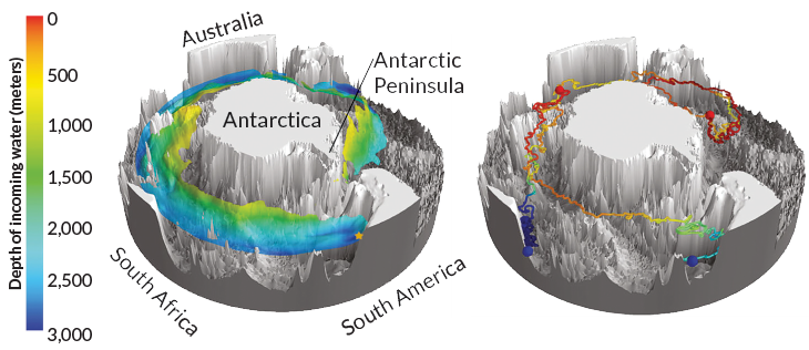
How deep water surfaces around Antarctica
3-D maps of upwelling could help climate scientists understand heat, carbon absorption
There’s no signpost to mark it, but about 3,000 meters underwater off the southeast coast of South America, a stream of deep water from the Atlantic Ocean spills into the Southern Ocean. Now new maps reveal in 3-D how the path of that water, called the North Atlantic Deep Water, spirals southeastward and up toward the surface around Antarctica.
The incoming water, part of the global conveyor belt of currents circulating throughout the oceans, is relatively warm and salty compared with the rest of the Southern Ocean. Researchers marshaled ocean temperature and salinity data to broadly map the deep water’s path (see map, below left). The data show that some of the water upwells close to the continental shelf along the western Antarctic Peninsula. Such intrusions have been linked to the melting of ice shelves.