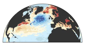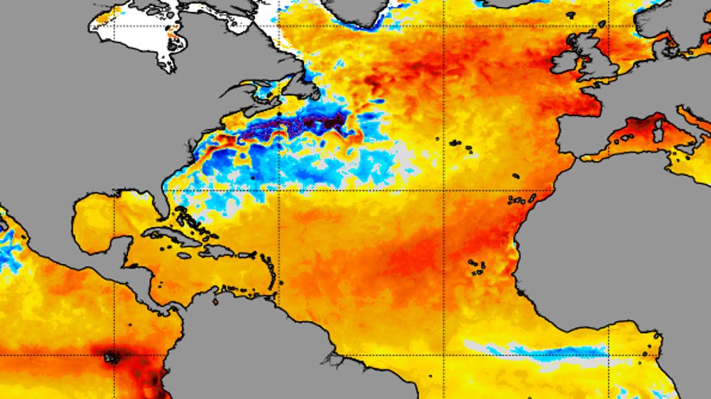
Large swaths of the North Atlantic are well above normal temperature (orange and red) for this time of year, a trend that could affect the forthcoming hurricane season.
NOAA
In the past few weeks, sea-surface temperatures in some parts of the North Atlantic Ocean have soared to record heights.
The anomalous warming is occurring in a large swath stretching almost one-third of the way across the Atlantic westward from the northwestern coast of Africa. Satellite data reveal that some surface waters in the area are almost 4 degrees Celsius (about 7 degrees Fahrenheit) above normal for this time of the year, says Brian McNoldy, a meteorologist at the University of Miami in Coral Gables, Fla.
“There’s been record-breaking warmth since March, but even more so now,” he says.
On June 10, for instance, the average sea-surface temperature for the portion of the Atlantic that stretches from the equator to 60 degrees north — up to southern Norway, southern Greenland and the central portions of Canada’s Hudson Bay — was 22.7° C (nearly 73° F). That’s about 1 degree C higher than the average recorded from 1991 through 2020, McNoldy notes. The previous record for the same date, 22.1° C, occurred in 2010.
Hot Atlantic
Sea-surface temperatures in the North Atlantic in 2023 (red) have been breaking daily records since March. In this plot, the 1982–2022 daily mean temperatures have been subtracted from this year’s temperatures as well of those from 1982 to 2022 (gray).

This year’s warmer-than-normal waters might help strengthen storms that form in the eastern Atlantic and eventually spawn hurricanes, scientists say.
What’s causing the unusual warm-up isn’t clear. But here’s a rundown of several factors that might be at play.
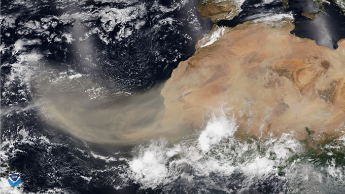
A dearth of Sahara dust
Occasionally, vast swathes of desert dust from the Sahara waft across the ocean. They are carried by winds stirred up by a semipermanent high-pressure system dubbed the “Azores high” due to its proximity to those islands.
But lately, the Azores high has weakened and shifted southwest away from Africa. So those winds that typically pick up and transport Saharan dust westward over the North Atlantic are calmer and largely dust free, says Michael Mann, a climate scientist at the University of Pennsylvania.
As a result, solar radiation that normally would be scattered back into space by the dust reaches the ocean surface, warming the dark waters (SN: 9/25/01).
If and when the trade winds strengthen, increased dust from Africa could help cool the area somewhat.
Decreased air pollution
In 2020, new emissions rules kicked in for long-haul container ships that spew sulfate-rich exhaust plumes. There’s been some speculation that less pollution could lead to more heating. With fewer plumes scattering sunlight back into space, more radiation reaches the sea surface.
But some studies suggest that the cooling effect of ship plumes may have been minor to begin with: Not only do the exhaust plumes have a short life span, the pollutants can cause natural clouds to evaporate more quickly and thus lead to warming, not cooling (SN: 2/1/21).
Global warming trends
This year marks the return of El Niño, a climate phenomenon whose hallmark is warmer-than-normal sea-surface temperatures along the equator west of South America. By winter, there’s a more than 4 in 5 chance that the El Niño will be either strong or moderate, according to scientists with the National Oceanic and Atmospheric Administration’s Climate Prediction Center.
Each El Niño has its own personality (SN: 5/2/16). But in general, El Niño boosts average surface temperatures both on land and at sea worldwide, Mann says. Human-caused climate change has done the same, he notes.
But there’s still a lot of uncertainty about how current conditions may affect the coming forecast.
The unusually warm waters of the North Atlantic may tend to strengthen storm systems that later develop into tropical depressions and then hurricanes. But the El Niño that’s now developing in the equatorial Pacific may hamper their formation by strengthening winds in the upper atmosphere that can shear the tops off nascent hurricanes. How active this year’s hurricane season will be depends on which of these forces will prevail, scientists say (SN: 5/26/23).